GPS Tools - Maps or OpenStreetMap
GPS Tools - Maps or OpenStreetMap v.6.0.4

1 Year Free Updates
Introducing first ever community oriented Maps, Tracks & Sharing tool for Joomla. GPS Tools allows your users to submit GPS tracks and discuss. It supports GPX, KML formats of GPS tracks and can be integrated with popular social networking tools like JomSocial, Community Builder etc.
Features:
-
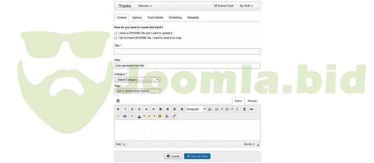
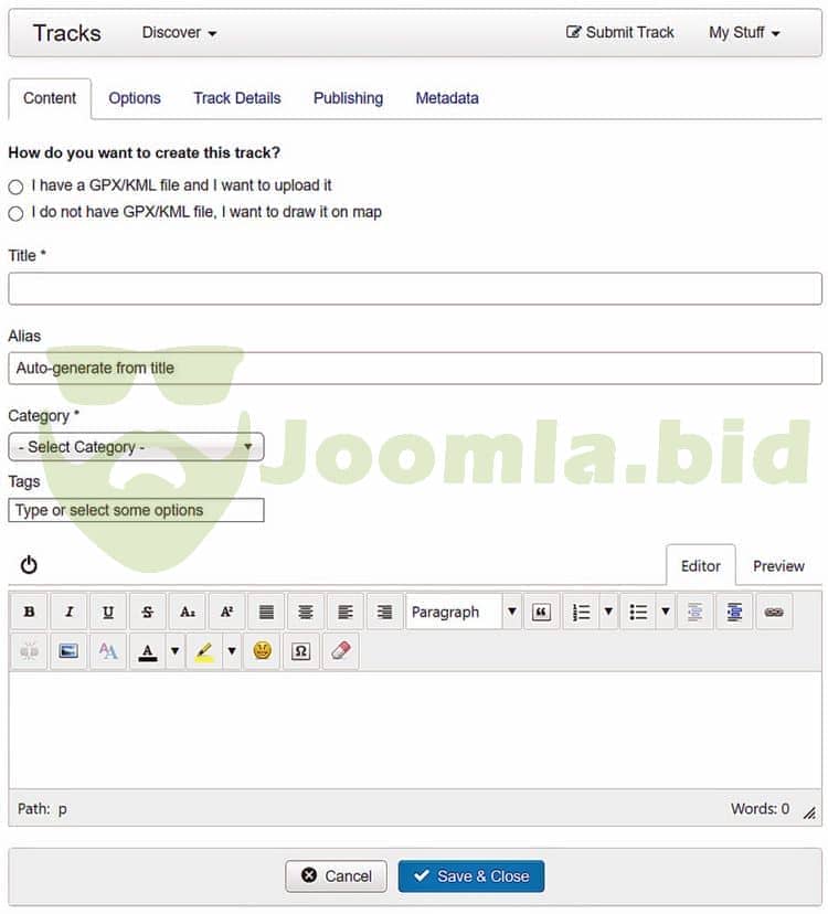
Quick Tracks: Now you can create tracks on the fly by drawing on the map instead of uploading files.
-
Responsive - works on your mobiles and tabs too
-
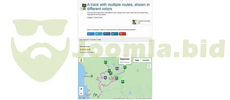
Multiple formats - Supports GPX, KML & KMZ file formats
-
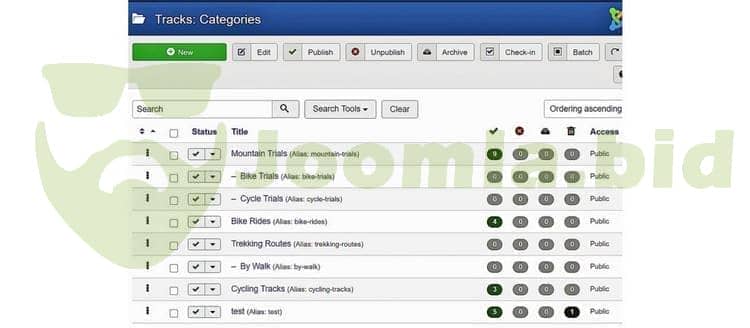
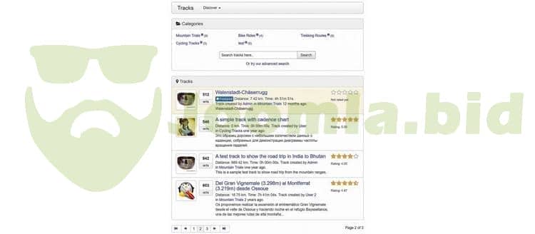
Categories - Multi-level categorization to better organize your tracks
-
Tagging support - Tag the tracks and browse faster
-
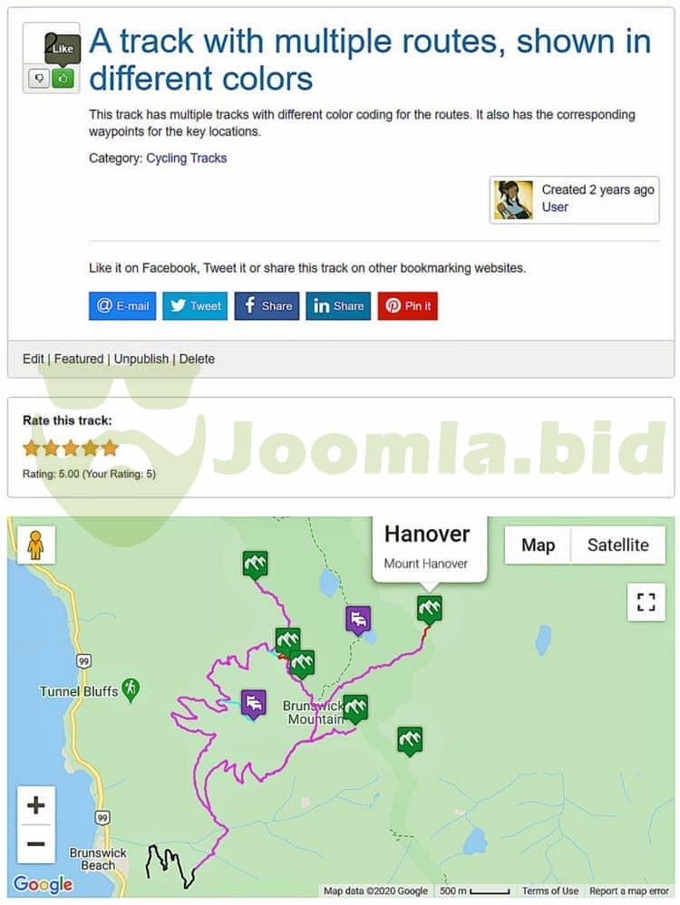
Ratings - 5 star rating system to rate tracks
-
Multiple map types - Map, Hybrid, Satellite, Terrain types
-
All track points module - to display the start points of all tracks submitted in any module position.
-
GPS tools module - to display latest, popular listings in module position with support for tabbed display of all lists.
-
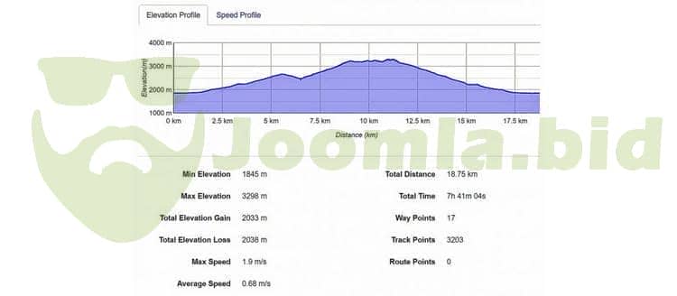
Fully customizable - Speed chart, Elevation Chart & Heart Rate Chart (GPX files only)
-
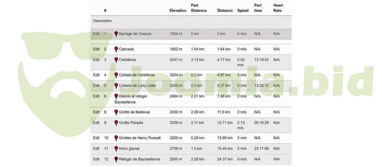
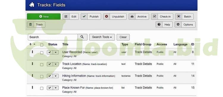
Way point tables - Displays useful information such as time, distance, statistics etc (GPX files only)
-
Configurable measurement types - in miles or kilometers, speed scale - mps or kmph
-
Controls - Scale control, zoom control, overview map
-
Content plugin to display track in Joomla Articles.
-
Submission Moderation - Moderate user submissions and approve right from email notification in your inbox.
-
User Avatars - CjForum, CjBlog, Gravatar, JomSocial, Community Builder, Kunena, Alpha User Points
-
Activity Stream - CjForum, JomSocial & EasySocial
-
Points System - CjForum, CjBlog, AUP, JomSocial, EasySocial
-
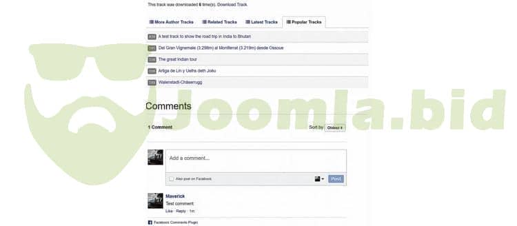
Comments System - Supports Disqus Comments, Intense Debate Comments, Facebook Comments, JAComment, JComments
-
Permissions system - restrict users from creating tracks, download or rate tracks etc.
-
Email notifications - to administrators about new tracks/moderation.
-
Social sharing and bookmarking
Get 10 Cents for every review you add.
